

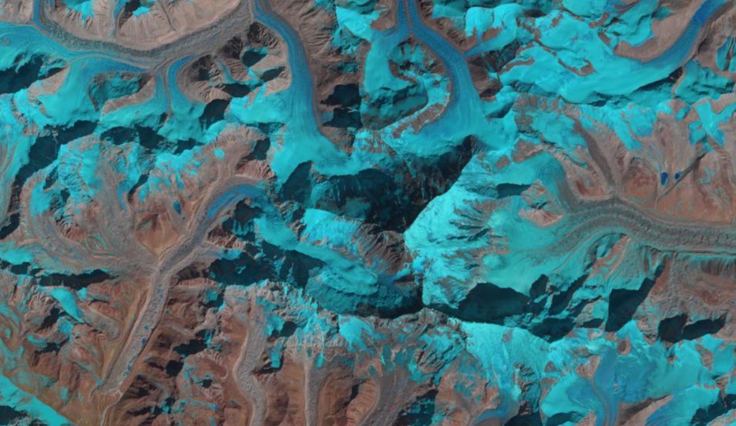
Mount Everest, acquired by Landsat-8 on 16th February 2020. Data courtesy of NASA/USGS.
Despite being the highest point on the planet, even Everest has felt the long reach of the pandemic, and we’re going to look at a couple of these impacts. The image n the left is Mount Everest acquired from Landsat-8. The mountain itself is the triangular shape in the centre of the image. The darker area is the side of the mountain in shade, and below are the other two sides of Everest.
Turning to the impacts of the pandemic on Everest, firstly, last week the Nepali Times reported that Mount Everest was visible from Kathmandu ‘for the first time in living memory’. Normally, the peak of the mountain is shrouded in smog; but the various lockdowns across the planet have significantly reduced air pollution in the Kathmandu Valley that has enabled the mountain to become visible.
Secondly, a twelve strong Chinese mountaineering team, including two surveyors, will climb to the peak of Mount Everest later this week – weather permitting. This is part of a scientific expedition China is undertaking to take advantage of the closure of the climbing season due to Covid-19.
The team are part of a fifty-three member group on Mount Everest, known locally as Qomolangma, measuring the mountain’s height, snow depth, weather and wind speed to help understand what is happening to the glaciers and the impacts of climate change. They are being supported in this venture by data from the Chinese Beidou satellite navigation network, an alternative to both GPS and Galileo from the USA and Europe respectively.
The Chinese have reportedly conducted six surveys of the mountain, which reported its height as 8,848.13 metres (29,029 feet) in 1975, and more recently as 8,844.43 metres (29,017 feet) in 2005. However, historical research has suggested that the first survey of the mountain was undertaken in the eighteenth century. This is contradictory to the Western view that believes European’s were the first to survey the mountain at the start of the nineteenth century.
The information about the Chinese survey comes from a paper published in 1958 by Zhou Qian, a researcher from the Palace Museum in Beijing. He indicated that the Chinese surveyors first mapped the mountain in the period 1715 to 1717. This was completed with various scientific instruments currently kept within the Palace Museum, including a semi-circle protractor with four movable pointers and a bronze quadrant. The results were recorded in Atlas of the Whole Imperial Territory in 1721, also known as the Kangxi Atlas. It is also the first recording of the Qomolangma, which translates to Holy Mother in Tibetan. Sadly, the height of Everest from this first survey was never recorded on the map, nor was it in the public files on the survey.
Finally, it’s also worth noting that during this period of limited climbing, China has also taken the opportunity to undertake a clean-up of the mountain, collecting, and removing, rubbish.
COVID-19 is impacting every part of our planet. No matter how isolated from the world you are, you can still feel the ripples of the pandemic.
