

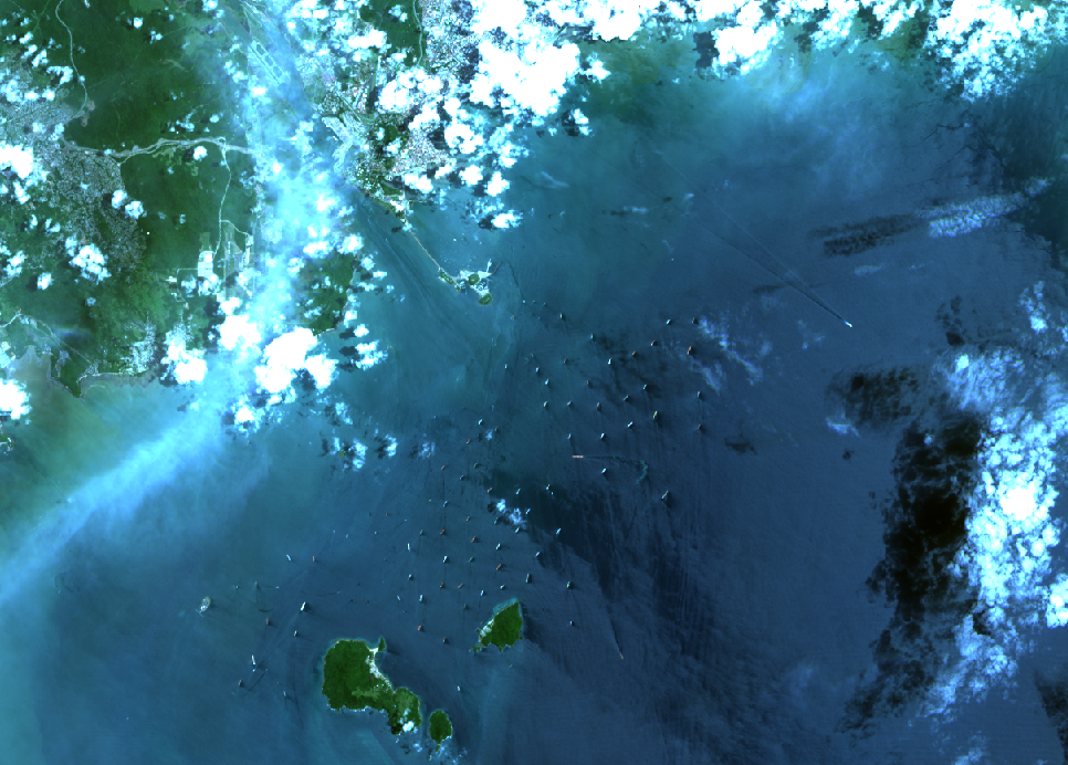
Landsat 8 image of the Panama City entrance to the Panama Canal. Image acquired on the 18th August, & is courtesy of USGS/NASA.
Wildfires, storms and flooding have hit the headlines numerous times this year with climate change a key factor, but the latest impact is on the Panama Canal that has had to reduce the number of ships passing through it.
The Panama Canal is an artificial 51 mile waterway, in Panama, that connects the Atlantic Ocean with the Pacific Ocean and divides North and South America. The link between the Atlantic and Pacific Oceans was a huge improvement when it opened on the 15th August 1914, as ships no longer had to go around Cape Horn at the bottom of South America saving a huge amount of time and cost. Today, an estimated £210 billion worth of cargo equating to almost 3% of the global maritime trade goes through the Panama Canal, and connects 180 routes in 170 countries.
The canal operates with three sets of locks. On the Atlantic side are the Gatun locks lifting vessels up to Gatun Lake, 26 metres above sea level. While the Pacific side have both the Miraflores and the Pedro Miguel Locks. It takes an average of eight to ten hours to transit the canal, a passage that requires an average of 200,000,000 litres of fresh water, unlike the Suez canal that has no locks and is just seawater. This freshwater is provided by two artificial lakes which are filled by rainwater, something normally abundant in Panama, but drought conditions have led a shortage of rain, linked to the El Nino warming phenomenon. As a consequence, the lakes have less water in them, with Gatun Lake at near record low levels. The lakes also supply drinking water to 4.2 million people in Panama, about half the country.
As a result the number of vessels passing through the Canal has been reduced by twenty percent, from an average of 40 to 32, and this has included preventing vessels with a depth of greater than 13.11 metres transiting the waterway.
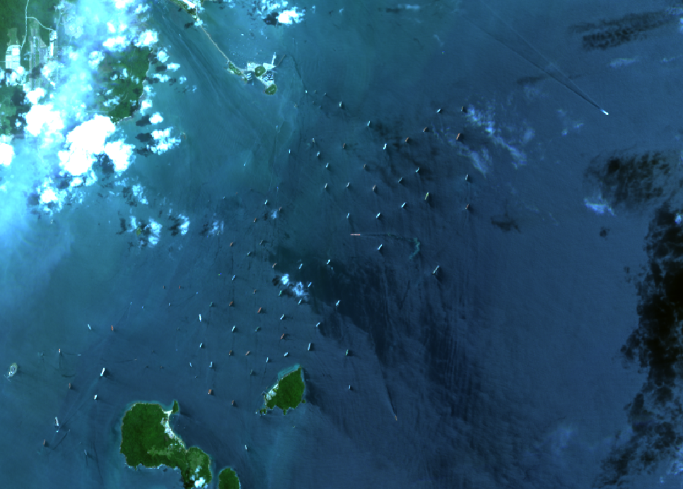
Landsat 8 showing the vessels lined up awaiting passage through the Panama Canal at the Pacific Ocean entrance. Image acquired on the 18th August, and is courtesy of USGS/NASA.
This has led to a queue of vessels waiting outside of the Canal that can be seen from space. The Landsat 8 image, acquired on the 18th August, at the top of the blog shows the Pacific entry to the Canal and the zoomed in version to the right clearly shows the row of vessels lined up outside. The queue is currently around 130 compared to a normal 90, although it has been as high as 160 vessels; and waiting times have gone up from around five days, to an average of 11 days, but some vessels have waited almost three weeks. The Panama Canal Administrators have also noted that without sustained rain over the coming months the restrictions could remain in place for a year.
While in Plymouth, we may be halfway across the world from the Panama Canal, the issues are similar here. The reservoirs with the water for Devon and Cornwall have been below average for many months now, and despite the rain we have had this year there is still more water required. The local water company is exploring desalination plants on the coasts to try and mitigate the issue going forward.
Summary
So often, developed countries try to ignore the impact of climate change as they don’t think it is directly impacting them, or they feel the cost is too high for something that might not happen. The weather events have brought climate change to their doors, but this still might not get them to act. Instead, remembering the impact the blockage of the Suez Canal in 2021 had on global supply chains, maybe, just maybe, an economic impact through the reduction in trade due to the restrictions on the Panama Canal might start to nudge the dial for action. It is a hope, and sometimes, hope is all we have
