

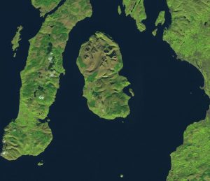
Isle of Arran, Scotland. Sentinel-2 image acquired on 28/10/2108. Data courtesy of ESA/Copernicus
Over the last week, there have three interesting examples of how remote sensing techniques are being used in archaeology to help improve our understanding of history.
Firstly, in Scotland, they’ve used airborne lidar on the Isle of Arran to identify approximately one thousand previously unknown archaeological sites such as prehistoric settlements, medieval farmsteads and a rare Neolithic cursus monument – a rectangular enclosure believed to have a ceremonial function. Given that Arran is only 432 square kilometres in size, this is a huge number of previously unknown sites.
The survey is the largest of its type so far in Scotland, and the researchers believe it could help find many other unknown archaeological sites in the country. These surveys produce 3D maps of the sites much faster than traditional methods and potentially identify sites potentially undiscoverable previously. The results of the survey are available to view on Canmore – Scotland’s National Record of the Historic Environment which has more than 320,000 records and 1.3 million catalogue entries for archaeological sites, buildings, industry and maritime heritage across Scotland.
More interestingly, it’s not just the survey results that are available. The datasets themselves are also freely available, under an Open Government Licence v3, in 10 km tiles which can be downloaded. These are on the Scottish Government Remote Sensing Portal alongside a number of other Scottish lidar datasets.
The second report also used airborne Lidar, this time over a rainforest in northwestern Belize to map Mayan farms in the area from thousands of years ago. The paper Ancient Maya wetland fields revealed under tropical forest canopy from laser scanning and multiproxy evidence by Beach et al was published on the 7th October 2019 in the journal Proceedings of the National Academy of Sciences of the United States of America.
A multispectral lidar sensor was flown at a height of 570 m across an area of 274.6 km, providing 11 billion returns from just over 6.5 billion lidar pulses. The researchers used these returns to create both a digital elevation model and multispectral images using three different wavelengths of 1 550, 1 064, and 532 nm.
The team discovered a large network of Mayan farms and canals dating back thousands of years in the low-lying wetlands areas. The wetland area identified was around five times larger than previously thought, and they discovered a large network of canals – some as long as a kilometre.
Finally, last week there was an article with space archaeologist Sarah Parcak highlighting a new site in Petra she has discovered using remote sensing techniques and satellite imagery. The site dates back two millennia and is believed to have been inhabited by the Nabateans – an ancient Arab people. The team used satellite imagery at a spatial resolution of 0.3 m and drone maps, alongside traditional archaeology techniques to make their discoveries including a ritual site dating back to the first or second century.
Sarah also leads the GlobalXplorer initiative, which is a citizen science project encouraging anyone to get involved in analysing satellite images to help identify and quantify looting and encroachment on sites of archaeological and historical importance. It also looks to identify sites that are currently unknown, like the new site in Petra. If you’re interested in participating in the work, you can do so here.
We’ve written about this application of remote sensing before, relating to the exploration of Angkor Wat, and it’s great to see continued expansion and use of remote sensing into other industries.
