

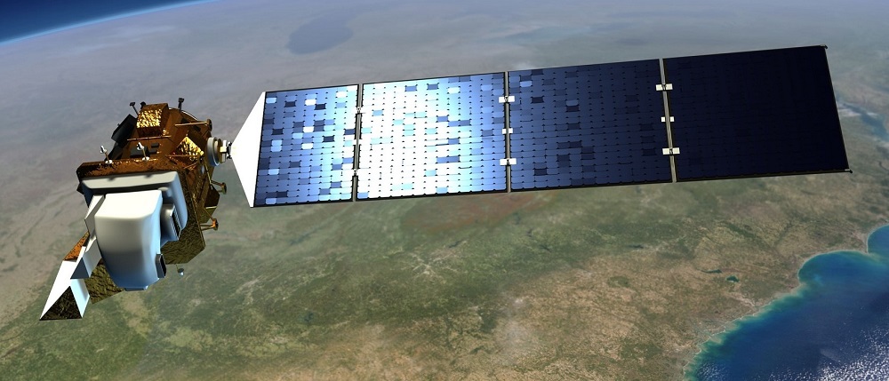
Artists rendition of Landsat 9. Image courtesy of NASA.
NASA are preparing to launch Landsat 9 which is scheduled for Monday 27th September from the Vandenberg Space Force Base in California using the United Launch Alliance (ULA) Atlas V 401 rocket – although there has already been a few days delay due to weather conditions, and so this might still move back.
Landsat 9 will carry two instruments, the Operational Land Imager (OLI) and Thermal Infrared Sensor (TIRS) which are almost identical to the instruments on Landsat 8, and will be named OLI-2 and TRS-2 for Landsat 9. Both instruments will use a pushbroom approach for data collection, and the specifications are:
- Operational Land Imager 2 (OLI-2) will take measurements in nine spectral bands in the visible, near infrared, and shortwave infrared bands:
- Band 1 Visible (0.43 – 0.45 µm)
- Band 2 Visible (0.450 – 0.51 µm)
- Band 3 Visible (0.53 – 0.59 µm)
- Band 4 Red (0.64 – 0.67 µm)
- Band 5 Near-Infrared (0.85 – 0.88 µm)
- Band 6 Shortwave Infrared (SWIR) 1(1.57 – 1.65 µm)
- Band 7 SWIR 2 (2.11 – 2.29 µm)
- Band 8 Panchromatic ( (0.50 – 0.68 µm)
- Band 9 Cirrus (1.36 – 1.38 µm)
The OLI-2 has a spatial resolution of 30 m for the multispectral bands, and 15 m for the panchromatic band; and it will have a swath width of 185 km. Whilst the OLI-2 is similar to the OLI on Landsat-8, Landsat 9 will download all 14 bits of data produced by OLI-2, providing a greater bit depth for its imagery, whereas Landsat-8 only uses 12-bit data, enabling addition information for dark targets.
- Thermal Infrared Sensor 2 (TIRS-2) will measure land surface temperature in two thermal infrared bands, using the same technology as TIRS on Landsat 8, namely:
-
- Band 10 TIRS 1 (10.6 – 11.19 µm)
- Band 11 TIRS 2 (11.5 – 12.51 µm)
TIRS-2 will be an improvement in instrument class and stray light reduction on its predecessor, as Landsat 8’s TIRS instrument has an issue that allows light outside the image to reach the focal plane and reduce the accuracy of its thermal measurements, especially for Band 11. The spatial resolution of TIRS-2 will be 100 m.
Landsat-9 is intended to be put into a near-polar sun-synchronous orbit at a distance of 705 km from the Earth, meaning it has a revisit time of 16 days to same point on the planet at the same solar time. This will be one hundred and eight degrees out of phase with Landsat-8, meaning that between the two satellites revisit times will only be 8 days. Landsat 9 will enter Landsat 7’s current orbit, and Landsat 7 will lower its orbit effectively ending its 22 year mission – albeit it was only designed for a five year mission life and so it has done really well to last this long, despite the data quality issues that have occurred during its life.
Like its predecessor, Landsat-9, will capture around 700 new scenes every day that will add to the almost fifty year Landsat archive, which is longest continual Earth Observation (EO) time series in the world. This began on 23rd July 1972 with the launch of the Earth Resources Technology Satellite (ERTS-1), later renamed as Landsat 1, that carried a multispectral scanner with four spectral bands. It was followed by Landsat 2, 3, 4 and 5 and then, unfortunately, Landsat-6 failed to reach its orbit on launch. This brings us to the current position with Landsat-7 and Landsat-8 in orbit, and obviously Landsat-9 will be the next satellite in this record breaking series. As at the end of June 2021, there were over 9 million scenes available within the Landsat archive.
Almost everyone working in EO has used Landsat data at some point during their career, and lots of products and services are built on this remarkable time series. Everyone in the industry is looking forward to the latest satellite launch, and seeing the data it will collect in the coming years!
