

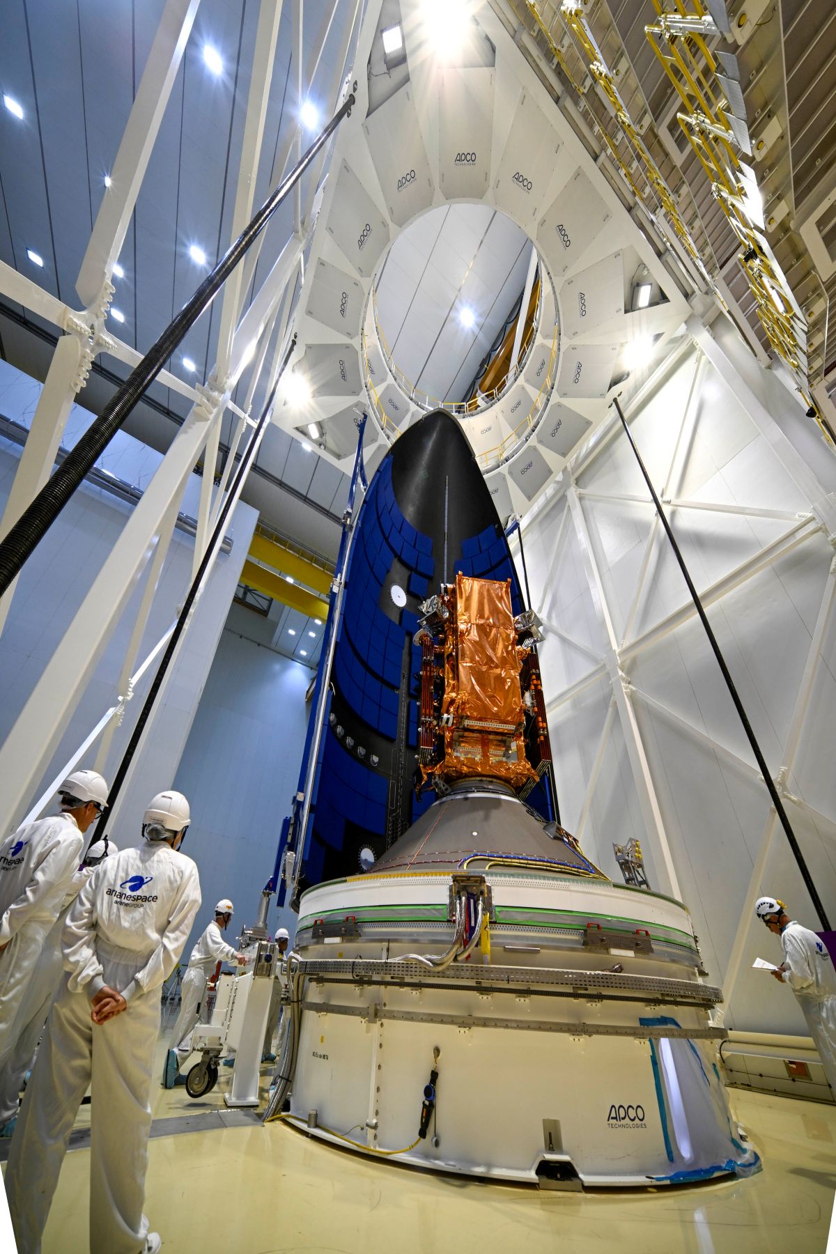
Sentinel-1D satellite encapsulated inside the Ariane 6 fairing getting ready for launch.
Imafe credit: ESA – M. Pédoussaut
Last night saw the successful launch of Sentinel-1D aboard an Ariane 6 rocket from Europe’s Spaceport in Kourou, French Guiana. The rocket was launched just after 22:00 (CET) and was put into a sun-synchronous orbit at approximately 693 kilometres.
As the letter D in the name suggests, this is the fourth satellite in the Copernicus Sentinel-1 mission, following:
- Sentinel-1A that launched on 03 April 2014,
- Sentinel-1B that launched on 25 April 2016 but ceased working at the end of 2021 due to a technical anomaly; and
- Sentinel-1C that launched on 05 December 2024
The satellites operate in pairs and once Sentinel-1D has completed it’s commissioning phase, it will take over from Sentinel-1A which will be decommissioned following it’s 11 years in space, well beyond the expected lifetime.
The Sentinel-1 satellites have a C-band synthetic aperture radar (SAR) instrument on board, which captures high-resolution imagery of the ocean, land and ice and being a SAR instrument it operates in all weathers. They are also equipped with Automatic Identification System (AIS) instruments for the detection and tracking of ships; and Sentinel-1D is also compatible with the Galileo navigation system, and other Global Navigation Satellite Systems.
Working as pair Sentinel-1C and -1D will acquire SAR data every six days in several modes, with the most common being the Interferometric Wide swath mode, meaning it takes three scans and combines them into a single image. Each scan has a width of 240 km and a spatial resolution of 5 m x 20 m.
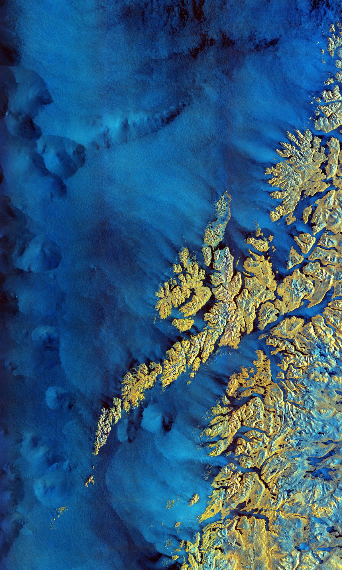
Copernicus Sentinel-1 mission takes us over the archipelago of Lofoten in northern Norway. The colours come from the combination of two ‘polarisations’ on the satellite’s instrument. Image Credit:
contains modified Copernicus Sentinel data (2020), processed by ESA
The data from the Sentinel-1 mission is used for a variety of land and ocean applications including tracking sea ice and oil spills, mapping land use changes, land subsidence, assessing soil moisture, iceberg and glacier monitoring, and aiding in emergency response to disasters like floods, volcanoes and earthquakes.
The data is also ingested into various Copernicus Services such as the Copernicus Emergency Management Service (CEMS) for flood mapping, the Copernicus Maritime Surveillance (CMS) Service for oil spill and vessel detection, and the Copernicus Marine Service (CMEMS) for monitoring icebergs and sea ice concentration to support safe navigation, supports the Copernicus Land Monitoring Service (CLMS) for vegetation, forest and agricultural monitoring including to detect and track ground motion from subsidence, landslides, volcanic activity and earthquakes.
It is great to see the continuation of the Sentinel-1 mission with the new satellite, and we’re excited with the extension of this dataset and seeing what more we can learn from the data it collects.
