


Sentinel-4 image depicting tropospheric nitrogen dioxide with clear pollution hotspots visible along the Mediterranean coast and over Italy’s Po Valley. Image Courtesy of ESA and contains modified Copernicus Sentinel data (2025), processed by IUP-Bremen/DLR/ESA.
Looking this week at the first light images of the Sentinel-4 mission, together with the latest Earth Observation (EO) satellite launches from China.
Sentinel-4
As the European Union’s Copernicus Programme builds up to the launch of Sentinel-1D early next month, they released the first images from the recently launched Sentinel-4 mission this week. The Sentinel-4 mission was launched at the start of July aboard the European Space Agency’s (ESA) Meteosat Third Generation Sounder (MTG-S1) satellite into a geostationary orbit of 36,000 kilometres, and it carries a ultraviolet–visible–near-infrared spectrometer with a spatial Resolution of 8 km x 8 km. By hosting Sentinel-4 on the MTG-S1 satellite allows the gathering of combined meteorological and atmospheric composition data on a single platform.
Although, still undergoing its commissioning phase, four initial images released are:
- Tropospheric nitrogen dioxide map, shown at the top, with clear pollution hotspots visible along the Mediterranean coast and over Italy’s Po Valley – on the right of the image is cloud cover as Sentinel-4 cannot measure nitrogen dioxide over areas covered by cloud.
-
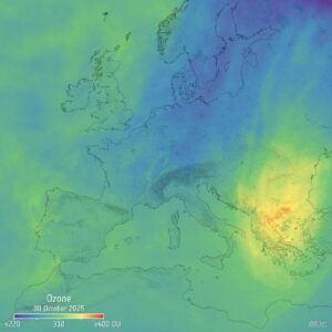
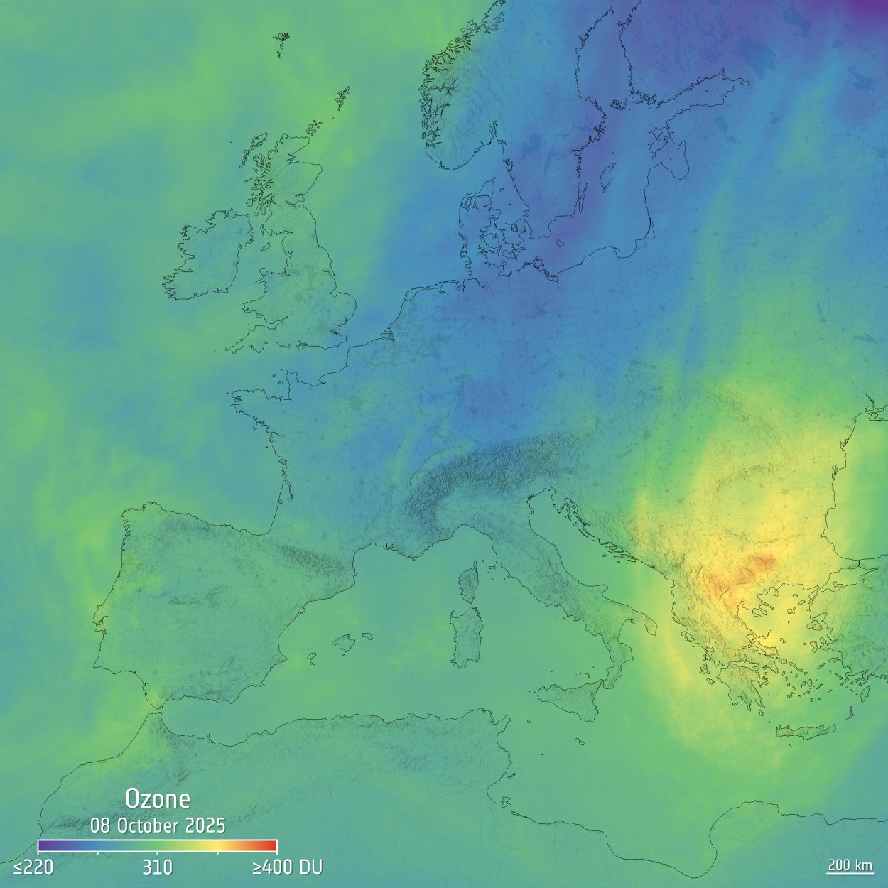
Sentinel-4 image of a vertical column of ozone. The overall ozone levels here are within the expected range, with maximum levels over the Balkans and Greece and a minimum over the Baltic region. Image courtesy of ESA and contains modified Copernicus Sentinel data (2025), processed by DLR/ESA.
Vertical column of ozone shown on the right, which are within expected ranges. The large-scale distribution, featuring a maximum over the Balkans and Greece and a minimum over the Baltic region, is consistent with patterns detected on the same day by heritage instruments.
- Europe and part of North Africa using the first Earth radiance spectra measured by Sentinel-4. Processed in false colour, measurements have been assigned to red, green and blue, and show the land, ocean and clouds as expected.
- Vertical column density of sulphur dioxide is shown below with a distinct plume can be seen emerging from Mount Etna in Italy and drifting south-eastwards over the sea.
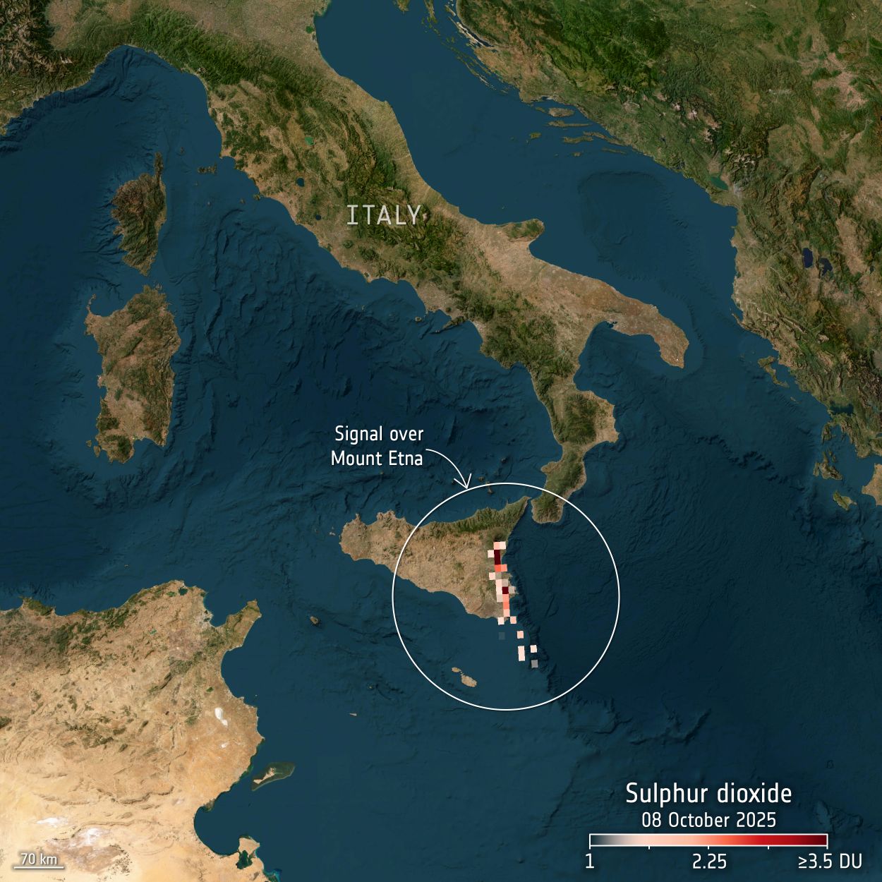
Sentinel-4 image showing a vertical column density of sulphur dioxide. A distinct plume can be seen emerging from Mount Etna in Italy and drifting south-eastwards over the sea. Image courtesy of ESA and contains modified Copernicus Sentinel data (2025), processed by BIRA/DLR/ESA
Once operational the mission will routinely map concentrations of nitrogen dioxide, sulphur dioxide, ozone, formaldehyde, glyoxal and aerosols, with data available through the Copernicus Atmosphere Monitoring Service.
Chinese Satellite Launches
On 19th October several satellites were launched from the Jiuquan Satellite Launch Centre in China on a Kinetica-1 rocket. These were:
- AIRSAT-03, also known as TerraX-1 is an X-band Synthetic Aperture Radar (SAR) satellite developed by TerraXpace Sdn Bhd and is Malaysia’s first SAR satellite. It is expected to provide high-resolution data, although the specifications have not been made available at this time. The data from the satellite is expected to be used for applications including disaster response, agricultural monitoring, environmental protection, infrastructure planning, together with coastal and maritime surveillance. TerraX-1 is hoped to be the first of a constellation of satellites
- AIRSAT 04, also known as Beibuwan 1, satellite is also a X-band SAR satellite, but this satellite was developed for China by the China Science and Technology Satellite Group Co., Ltd. Similarly, limited information is available about its specification.
- Hyperspectral Satellite (HS-1) is, as the name suggests, a hyperspectral EO satellite for Pakistan and has hundreds of spectral bands. The data is expected to be used for applications such as land use, vegetation health, water resources, and urban development. This is Pakistan’s first hyperspectral satellite and was launched by The Pakistan Space and Upper Atmosphere Research Commission (SUPARCO). It was the third satellite for Pakistan launched by China this year, following PRSC-EO1 in January and the Pakistan Remote Sensing Satellite (PRSS-1) in July which we discussed in a previous blog.
A week later, on the 26th October, the Gaofen-14 02 EO satellite was launched on the Long March 3B rocket from the Xichang Satellite Launch Center. The satellite’s manufacturers describe Gaofen-14 02 as being capable of delivering high-quality stereo imagery globally, alongside providing data to support for economic development and defence capabilities – although information on the specification of the instrument is limited.
Conclusion
Very exciting to see the first light images from Sentinel-4, and as it comes into operational use it will provide regions with near-real time updates on key atmospheric constituents which should enhance air-quality assessments and support pollution forecasting and monitoring. Alongside this, is the continued development of EO capabilities with the latest Chinese launches of hyperspectral and optical satellites.
