

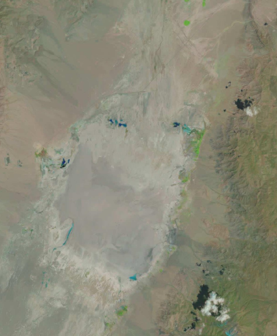
Railroad Valley Calibration Site, Acquired by Landsat 9 on 23rd May 2023. Data courtesy of USGS/NASA.
It’s not often that satellite ground-based calibration methodology hits the headlines, but it happened last week. This was because the United States Bureau of Land Management announced that following a request from the National Aeronautics and Space Administration (NASA), approximately 22,684 acres of public land in Nevada is no longer available for exploration and mining.
This followed an application from the United States mining company 3 Proton Lithium which holds the claim for the area and believes there is a significant lithium deposit beneath the lakebed. However, for the last 30 years, NASA has used the Railroad Valley dry lakebed for conducting ground-based calibration of Earth Observation (EO) satellite instruments.
Calibration
Calibration is the process by which a satellite instrument is tested to ensure that its data is accurate and the measurements are compatible with international standards. Specific sites worldwide are used with ground measurements taken and then compared to measurements received by the instruments on satellites, and any issues with the satellite instruments can then be identified and rectified. Calibration is often redone throughout the life of a satellite instrument for various reasons to ensure data quality remains high. At Pixalytics, we’ve been involved in activities related to data quality and calibration for several years, and we’ve even been known on occasions to consider whether it be worth owning land to establish a calibration site – only to remember we live in the UK and the number of cloud-free days we get would restrict its use significantly.
Railroad Valley is an essential site as its a large flat area; free of vegetation and most human activity; often has cloud-free skies; and has a consistent surface colour. EO instruments that have used this site include those on Landsat missions, MODIS’s Aqua and Terra instruments, the Orbiting Carbon Observatory -2 & -3 missions and a number of New Space missions such as Planet’s constellations. NASA described the Railroad Valley site as ‘the best site in the United States for satellite calibration’.
NASA highlighted that the mining activity would disrupt the qualities that make the site perfect for calibration and would risk the site becoming unusable. Consequently, under the Materials Act of 1947, the Bureau of Land Management has withdrawn the rights for exploration and mining to preserve the integrity of the land surface for twenty years, starting in April 2023. The land is reserved for NASA satellite calibration activities.
Given how often EO has to fight its corner for bandwidth with mobile data companies, it is heartening to see NASA being successful here – even though lithium is critical to the space industry and many others!
