

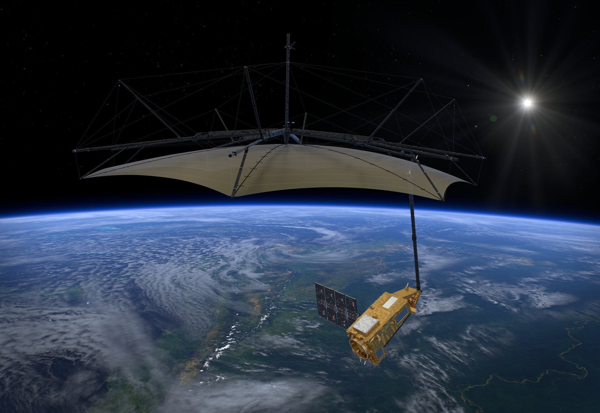
Artist’s impression of Biomass satellite in space. Image credit: ESA/ATG medialab, CC BY-SA 3.0 IGO, ©ESA.
Next Tuesday morning, 29th April, should see the scheduled launch of the European Space Agency’s (ESA) Biomass mission, the latest of the Earth Explorer missions. Biomass is focused on improving our understanding of the world’s forests and how they are changing, and it aims to determine the amount of biomass – the renewable organic material from plants and animals – and carbon stored in forests.
This Earth Observation satellite will be launched by a Vega C rocket from the European Spaceport in Kourou, French Guiana, and put into a sun-synchronous orbit at an altitude of 666 kilometres. It will be the first satellite to carry a P-band synthetic aperture radar (SAR) instrument; and it has circular antenna of 12 metres in diameter, with the data having a swath width of 60 kilometres.
Being a SAR based instrument Biomass will not be affected by clouds, and it will also be able to penetrate the canopy layer, to enable the biomass of trees to be estimated, even to the forest floor. Forests absorb and store carbon as biomass, and it’s estimated that 50% of the weight of a tree is carbon, which is stored within its woody biomass. This makes forests and trees vital to addressing climate crisis, and having healthy forests are important to everyone.
During its expected mission lifetime of 5.5 years, the satellite will be operated in two phases:
- Tomographic phase for the first 18 months, which operates similar to a hospital CT (computed tomography) scan, by combining several images to create 3D maps of forests with a 15–20 metre vertical resolution, and 200 metre spatial resolution.
- Interferometric phase will be used for the remaining four years. This will use a single observation to give a view of the forest canopy and forest density, and by comparing several of these images over the same area will allow forest height and above-ground biomass to be estimated. During this period, approximately five global maps will be created.
In addition to the mission’s primary aim of determining the biomass of forests, the data is also expected to be used to:
- reduce uncertainties in calculations of carbon stocks and fluxes on land – factors such as rising temperatures, increasing atmospheric carbon dioxide concentrations and human activities impact forest carbon dynamics.
- improve understanding of the role forests play in the carbon cycle.
- support global action to reduce deforestation and forest degradation.
- monitor sub-surface geological features in arid and semi-arid regions.
- track the movement of icesheets in Antarctica.
- enable scientists to model terrain covered by dense forests.
Once the data from Biomass is made available, ESA has several tools available for processing, analysing, and visualising the data:
- Biomass Product Algorithm Laboratory (BioPAL) is an open-source scientific computing project, supporting the development of ESA’s Biomass mission algorithms coded in Python.
- Earth Observation Swath and Orbit Visualisation (ESOV) tool provides the means to visualise the instrument swaths of all ESA EO satellites.
- Polarimetric SAR data Processing and Education (PolSARpro) supports the scientific exploitation of polarimetric SAR data and for high-level education in radar polarimetry.
Summary
Improving our understanding of forests and their role in the carbon cycle are critical to better understanding the impacts of climate change, and it is fantastic that the Biomass satellite is launching and offering the potential to enhance our knowledge in these areas.
