

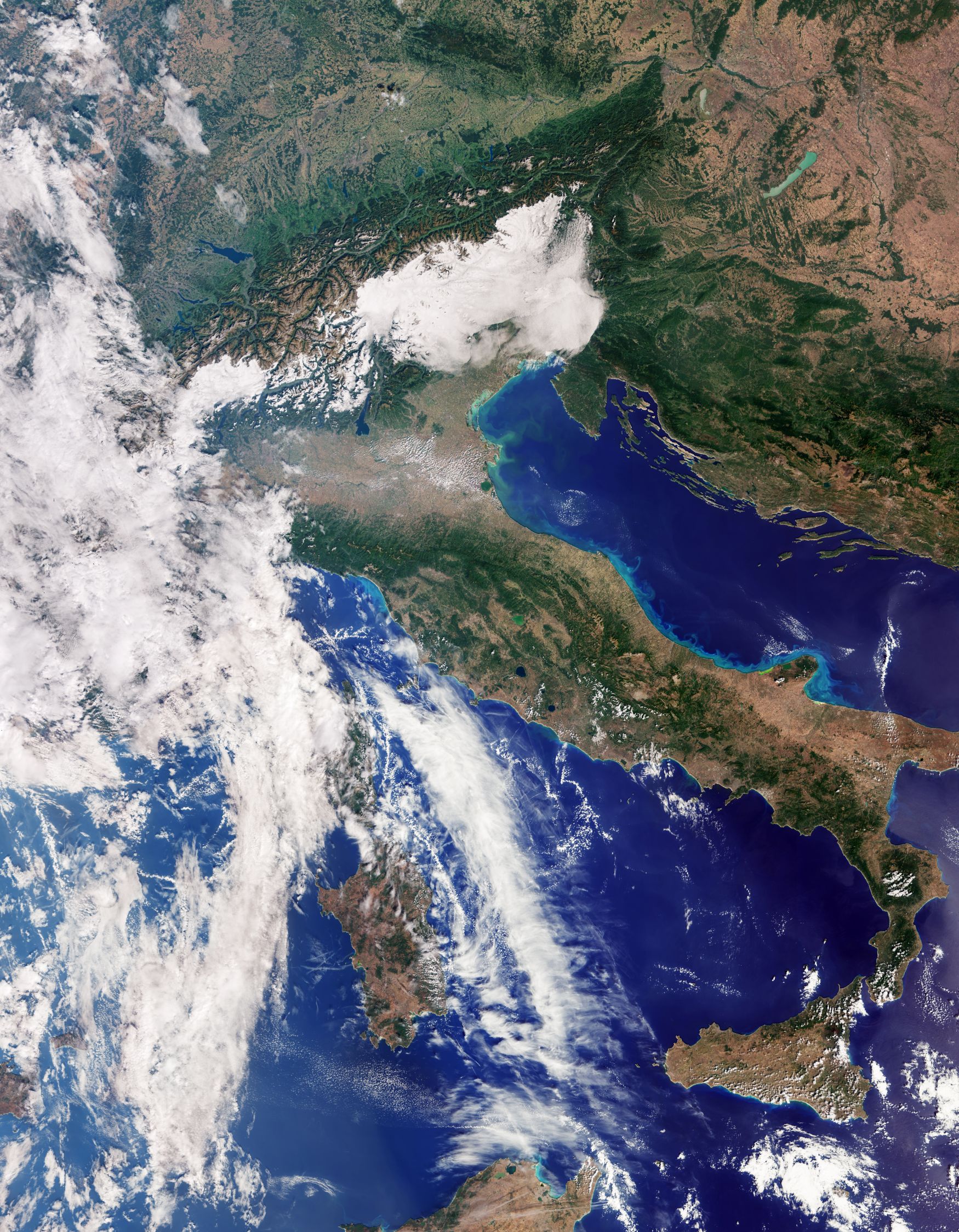
Image of Italy acquired by Sentinel-3C on the 30th September 2026. Image contains modified Copernicus Sentinel data (2026), processed by ESA.
We often discuss the launches of new Earth Observation satellites, but this week we’re moving onto a new satellite’s next key stage – the first images it acquires. In this blog, its the first light images from Sentinel-3C and the latest Eaglet II satellites.
Sentinel-3C First Light Images
Last month we highlighted the launch of the Copernicus Sentinel-3C satellite, and this week the Copernicus Programme has released the first images from the satellite’s ocean and land colour imager (OLCI).
OLCI is evolution of the MERIS instrument that was onboard Envisat and offers 21 spectral bands with a spatial resolution of 300 metres. The images are acquired using five side-by-side telescopes operating in a pushbroom approach and together offer a total swath width of 1270 kilometres, which enables global coverage in two days.
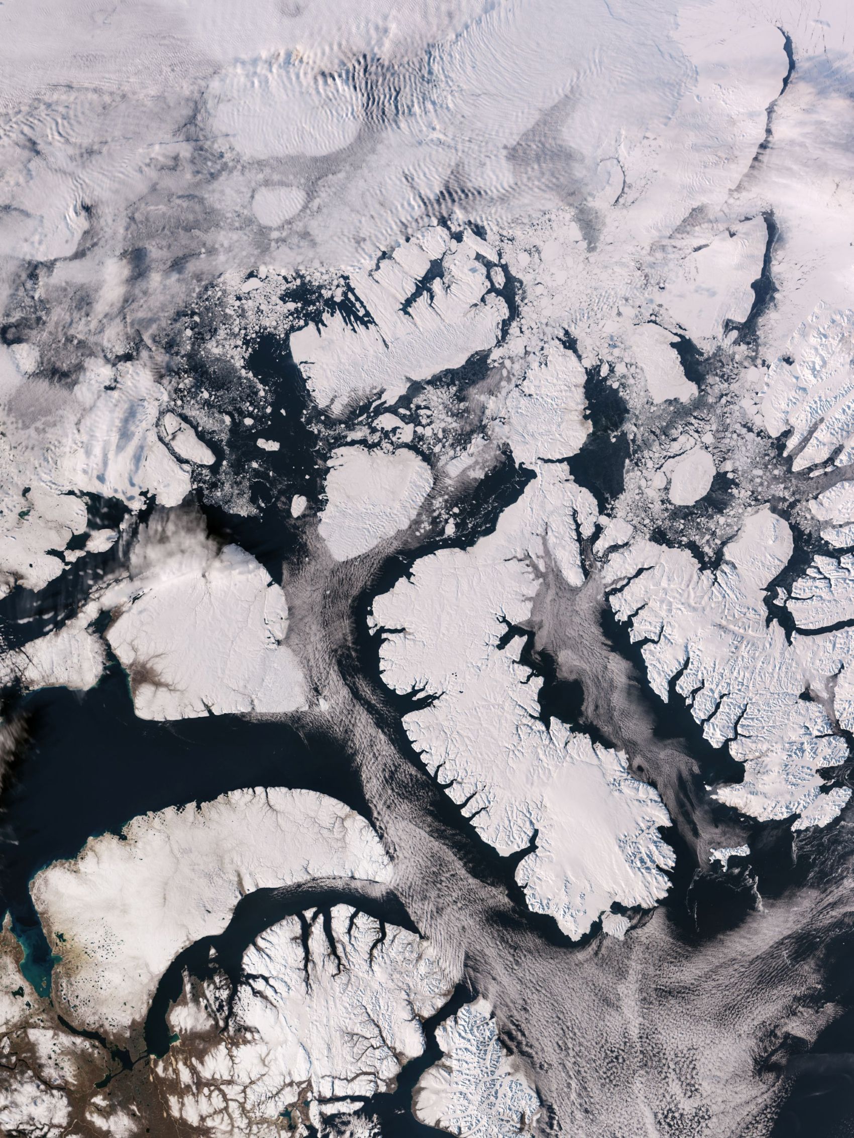
Image of Canadian Arctic Archipelago acquired by Sentinel 3C on 30th September 2026. Image contains modified Copernicus Sentinel data (2026), processed by ESA.
The set of initial images released includes views of Italy, the Canadian Arctic and the Caribbean from the satellite’s ocean and land colour instrument, as well as measurements of the height of the Greenland ice sheet and sea surface from its synthetic aperture radar altimeter.
The first image, shown at the top of the blog, starts with southern Germany at the top, and then goes through the Alps, where the snow-capped peaks are clearly visible. Below this is the mostly brown area of the Po Valley that covers 46,000 square kilometres of northern Italy, and then various shades of browns and greens of the rest of the country. The ocean colour part of the instrument comes to the fore on the eastern side of Italy, where the different colours in the water can be seen, with the different shades of blue and the coastal features, higher sediment and phytoplankton concentrations, showing up as the lighter blue and green colours. This image was acquired on the 30th September.
Acquired on the same day, was the image above showing the Canadian Arctic Archipelago with ice- and snow-covered islands. The sea ice is minimal at this time of year, but there are ice flows visible at the top.
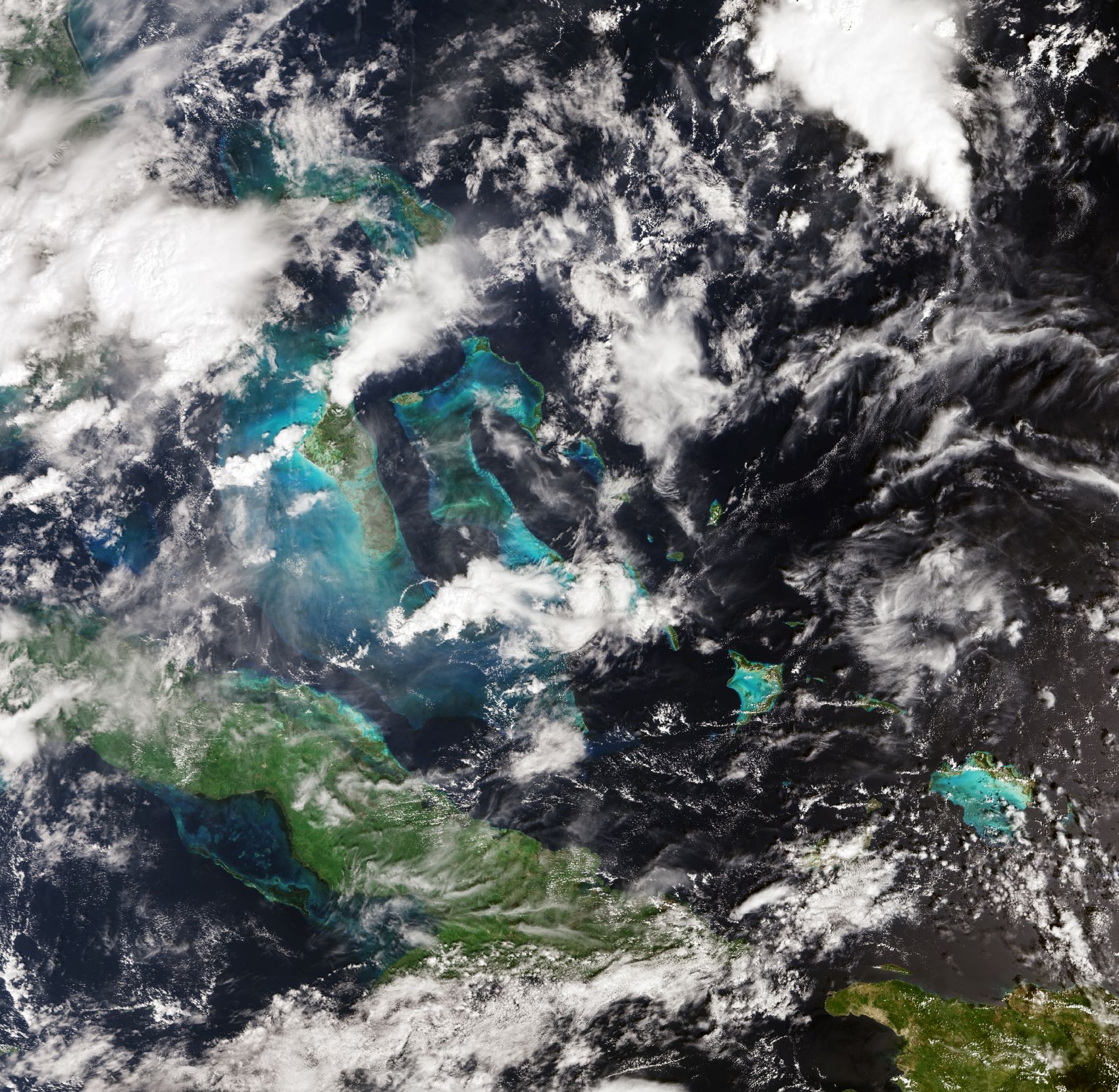
Image showing part of the Caribbean acquired by Sentinel-3C on 29th September 2026. Image contains modified Copernicus Sentinel data (2026), processed by ESA.
Finally, the image to the left shows part of the Caribbean, with Cuba to the south and the Bahamas towards the top. Again, ocean colours are visible, with darker, deeper water in the open sea and lighter, shallower water around the islands, where light can reflect from the seabed. There are clouds on the image too, which was acquired the day before the other two on the 29th September.
Fantastic to see the first acquisitions for OLCI, while the first measurements from the sea and land surface temperature radiometer are expected in the near future.
IRIDE Eaglet II First Light Images
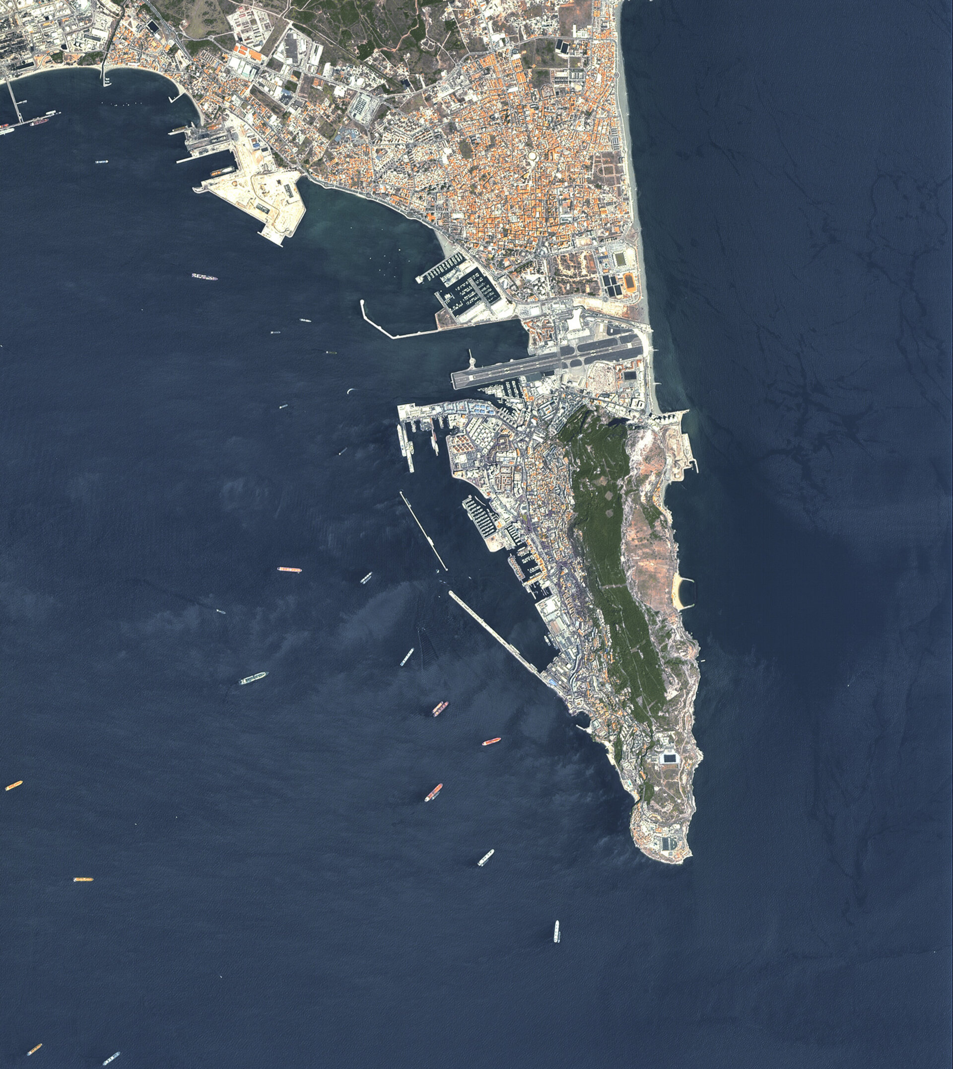
Image showing Gibraltar as acquired by the latest IRIDE Eaglet II satellite. Image courtesy of IRIDE.
More first light images have been released from the latest eight IRIDE Eaglet II satellites for the Italian Space Agency, whose launch we covered last week. This was the third batch of eight satellites launched in this constellation, with previous launches in November 2025 and March 2026. The twenty-four satellites each carry a high-resolution multispectral optical imager offering a spatial resolution down to 2 metres, with a swath width of 18.3 kilometres.
The latest batch were launched successfully and began acquiring images soon after, with some of those first images released this week, including the image to the right, showing the UK territory, Gibraltar. The Rock of Gibraltar is clearly visible down the centre of the Peninsula alongside the dense urban areas, port facilities and airport alonside ships in the water. The data from these satellites will be used for applications including land-cover, vegetation, and crop monitoring.
Summary
It’s always amazing to see new images, and the first ones from Sentinel-3 and Eaglet II don’t disappoint. It’s exciting to see what they are going to capture in the coming weeks, months, and years. We’ll be watching!
