
 The Open Geospatial Consortium’s (OGC) Disaster Pilot 23 public Demonstration Day took place yesterday, where all the results and achievements of the 2023 Pilot presented within a webinar. We discussed the OGC organisation itself in last week’s blog, and as part of their role for over 20 years they have been working on the challenges of information sharing for emergency and disaster planning, management, and response.
One part of this work is running Disaster Pilot activities that aim to address information and data gaps, together with providing support and guidance on how disaster and emergency communities can enhance their sharing and use of geospatial information and applications. The Disaster Pilot 23 (DP23) is the latest of these initiatives, and was sponsored by Natural Resources Canada, NASA, and the US Geological Survey.
DP23 focussed on developing several data workflows focused on drought and wildland fire disaster scenarios, together with a set of supporting tools for collecting, finding, and visualizing geospatial data. Pixalytics was directly involved in the DP23 activities in two aspects, we worked on the development of a Drought Severity Index, and were responsible for writing the Provider, User & Operational Capacity Guides, with the support of all the other participants.
The Demonstration Day involved all the participants highlighting their achievements in the Pilot by showcasing their work, together with looking at what the next steps could be.
Drought Disaster Scenario
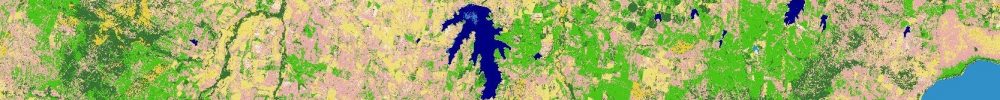
Several data workflows were developed for drought, focused on the province of Manitoba in Canada. Pixalytics was one of three organisations involved in developing Drought Severity Indicators, and we developed a Combined Drought Indicator workflow based on the research of Sepulcre-Conto et al (2012) that brought together measurements on precipitation, soil moisture, and vegetation stress into an OGC-complaint API through web processing services. The aim for this indicator was to support an understanding of whether a geographical location is suffering from drought and what the indication of drought is referring to, i.e. is it a lack of rain, lack of soil moisture, or stressed vegetation; the indicator shows how an area moves from watch to warning to drought. Other participants focusing on drought severity looked at providing climate data for forecasting future droughts, and a drought vulnerability assessment.
In addition, the other drought data workflows were a Crop Suitability Indicator highlighting the effect of local environmental conditions on crop health/yield; a Water Supply Indicator for the drought impact on freshwater availability; Health Risk Indicators – covering both drought Health Risk, and direct & indirect Health Impacts; & an Energy Climate Indicator designed to enable the energy industry and the policy makers to assess the impacts of climate variability and climate change on the energy sector.
Wildland Fire Disaster Scenario
While the wildland fire indicators, focused on the western United States, were a Wildland Fire Fuel Indicator that generates vegetation fuel type classification; a Wildland Fire Ignition Risk Indicator to identify fire ignition risks; a Wildland Fire Evacuation Indicator to help organize evacuation plans for populations affected by wildfires; a Wildland Fire Health Impact Indicator that identifies the vulnerable populations by combining population characteristics with health conditions; and Wildland Fire Immersive Indicator Visualization uses digital twins to demonstrate how immersive visualization coupled with an intuitive user interface and navigation can help planners access and act on the data from various sources.
Supporting Tools
Finally, a number of supporting tools were developed including various Registries and Catalogues to help find disaster specific datasets that the emergency and disaster communities might find helpful; Mobile phone applications to collect data – including the Emergency Location & Language Application (ELLA) and the FLORA Wildfire Mobile Application, and Indicator Visualization tools.
It was exciting to see the work that has been completed by all the different participants. Pixalytics concluded the presentations by discussing the work on the Guides, where:
- Operational Capacity Guide – Provides disaster and emergency management communities with a Capacity Development Framework outlining a set of incremental strategic actions across six areas for any disaster or emergency management team who want to establish, enhance or improve their geospatial function response to disaster events.
- User Guide – A non-technical showcase of the workflows and tools demonstrating what is possible and what opportunities there are for communities to use these solutions to support & enhance disaster planning, management, and response.
- Provider Guide – Describing the detailed technical requirements of the tools and workflows including the input data, the processing and transformations undertaken, and outputs produced; together with technical standards and operational standards used to enable these tools and workflows.
The webinar was recorded and it, together with the presentations, will be available for anyone to see the latest developments in using geospatial data in disaster scenarios. Once approved by OGC, the Guides and other publications from the Pilot will be released so the work and outcomes can be shared more widely.
This has been a really exciting project to participate in, and we look forward to taking this work forward further through future Pilot activities.