

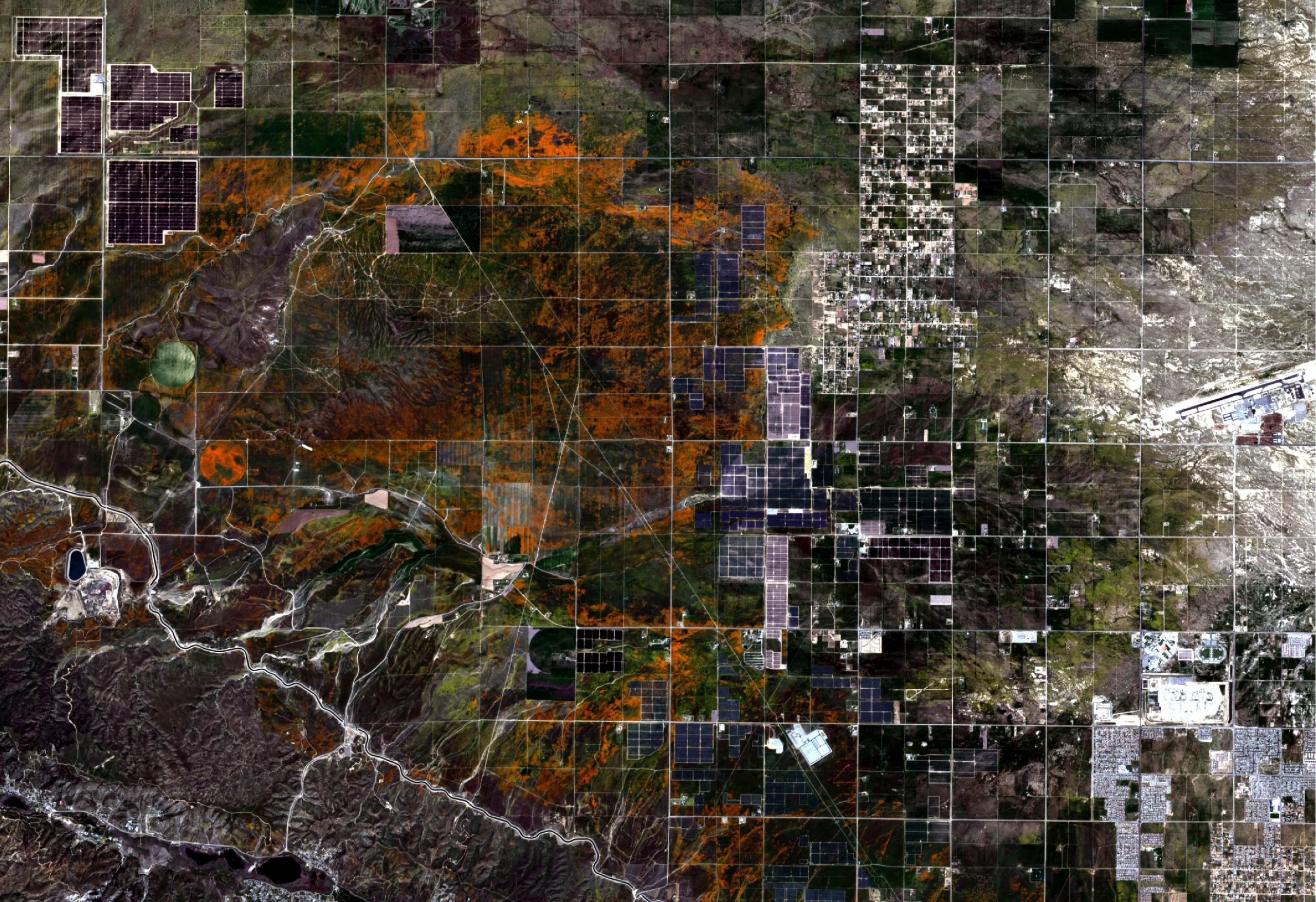
Poppies in bloom close to Lancaster, California, USA from Sentinel-2 acquired on the 23 April 2020. Image courtesy of ESA/Copernicus.
For everyone staying inside this week, we want to show you that nature, and the planet, continues on with its own cycle uninterrupted by what is happening to the human population.
The Mojave Desert, the driest desert in North America, currently has fields of poppies near its western tip that have turned the landscape orange, a change that can be seen from space. NASA, who has Armstrong Flight Research Centre nearby, released a report last week with an image from Landsat 8. We’ve downloaded images from both Sentinel-2 and Landsat-8 for this area.
The image at the top of the blog is from Sentinel-2 of the Antelope Valley near Lancaster, California and was acquired on the 23rd April 2020. The centre of the image has clear swirls and twists of the orange poppy fields. There are also lots of solar panels on the outside of the image, and on the right edge is the city the Lancaster.
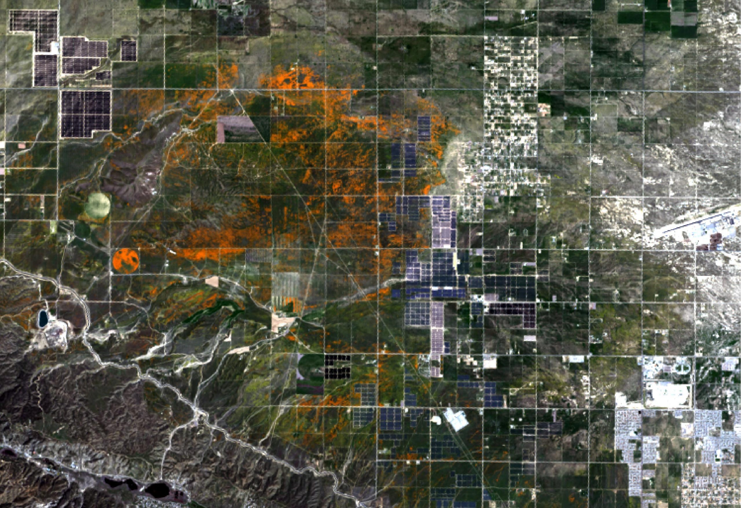
Poppies in bloom close to Lancaster, California, USA from Landsat-8 acquired on the 14 April 2020. Image courtesy of NASA.
To the right is the image of the same area from Landsat-8 acquired on the 14th April, which is the image used in the NASA report.
Whilst January and February were very dry in California, significant rainfall over the last two months – up between one hundred and fifty and two hundred per cent on expected levels – has encouraged the poppies to bloom. The poppy fields are being live-streamed by the Antelope Valley California Poppy Reserve, which you can find here. Although, do remember the time difference to California and if the live stream is black – which it was for me on my first look – then it’s probably night and so you can’t see anything. In my case it was 03.41 am which explained the picture!
While the orange poppies are visible from space the fields themselves are also home to cream cups, forget-me-nots, purple bush lupines, and yellow goldfields. These additional colours aren’t that visible due to them being in smaller clumps than the poppies and the spatial resolution of the satellites.
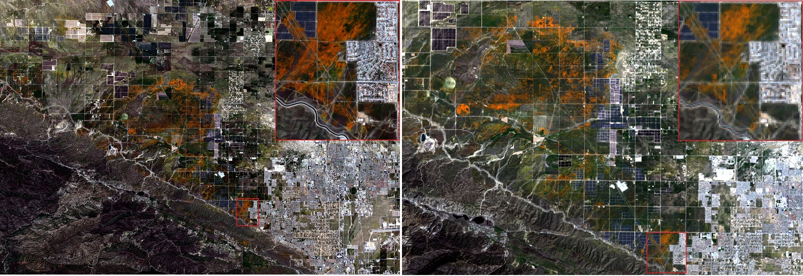
Images of Lancaster, California, USA with a zoomed-in section. Images from Sentinel-2 & Landsat-8, acquired on the 23rd and 14th April 2020 respectively. Images courtesy of NASA, ESA/Copernicus, with processing by Pixalytics.
Spatial resolution is the size of the digitized area, termed pixel, and effects the smallest object that can be seen on an image. For example, Sentinel-2 has a spatial resolution of 10 m squared on these images meaning that each pixel on the image represents 10 m on the ground. Whereas, Landsat-8 has a spatial resolution of 20 m squared and so each pixel on this image represents 20 m on the ground. The difference between the two can be seen in the image to the left, with the Sentinel-2 image on the left and the Landsat-8 on the right. Whilst there is only a small difference in the wide area, when you zoom in to both images as we have done on the top right corners the spatial resolution differences become more apparent.
Europe also has its flowering blooms with the Dutch Tulip fields giving a kaleidoscope of colours within rectangular tulip fields. ESA has produced a short time series showing the changes during the first three weeks of April around the town of Lisse in an area famous for producing tulips. The time series can be seen here, where the change of fields from brown to reds, greens and oranges can clearly be seen. The green colour is the tulip leaves, as farmers remove the flower heads quickly diverting energy back down to the bulbs to keep them strong and healthy.
These fields normally attract millions of visitors during this time of the year, but in 2020 the only way most people can see the sight is at a distance – and you can’t get much further than the 786 kilometres above the Earth of Sentinel-2!
