

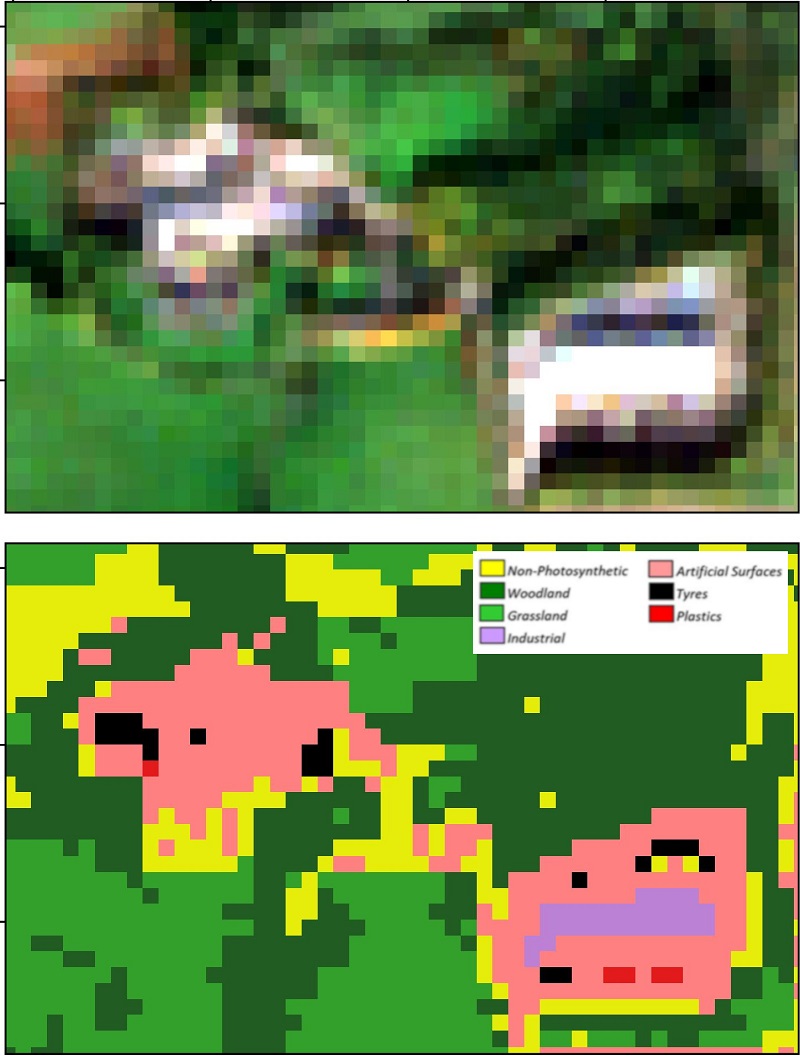
Graphical Abstract of paper by Page and Lavender et al. (2020) showing Sentinel-2 data and outcome of Land Cover Classification. Data courtesy of ESA/Copernicus.
This week we’re delighted to announce that we’ve got a peer-reviewed paper published in the open-access journal Remote Sensing. The paper titled ‘Identification of Tyre and Plastic Waste from Combined Copernicus Sentinel-1 and -2 Data’ by the author’s Page and Lavender et al. published on the 31st August and can be found here.
This paper results from a 6-month feasibility study Pixalytics completed last year with the Scottish Environment Protection Agency (SEPA) on the detection of waste tyres and plastics in both rural and urban environments. The work was funded through the European Union’s LIFE SMART Waste project that aimed to demonstrate innovative ways of understanding, tackling and reducing waste-related crime.
The project concluded with the ‘Smarter waste regulation and pollution crime enforcement’ conference in Brussels, where Dr Samantha Lavender from Pixalytics was able to present our results alongside Lorna McIver from SEPA, and this presentation can be watched here. Having presented the work we wanted to take the next step of writing up the results, and it was fantastic that SEPA were keen and supportive of this as often commercial projects end with the results only being seen by the customer. Not only because the results may be sensitive but also because of the time required to both write, and revise, a scientific paper for publication.
Our study aimed to develop an accurate classification method to provide a viable platform for repeatable, cost-effective, and large-scale monitoring. An augmented land cover classification was developed, which combines Copernicus Sentinel-2 optical imagery with thematic indices and Copernicus Sentinel-1 microwave data. Two Random Forests (RF) land cover classification algorithms were trained for the detection of tyres and plastics across Scotland. Testing of the method identified 211 confirmed tyre and plastic stockpiles, with overall classification accuracies calculated above 90%.
The approach can be automated but is highly dependent on the quality of the Sentinel imagery, e.g. needs cloud-free conditions. Therefore, we’re now working on these next steps to support automation. Also, we are expanding the approach to mapping marine plastics as part of a European Space Agency Open Space Innovation Platform funded project and detecting palm plantations as part of a UK Space Agency funded EcoProMIS project, which aims to improve the rice and oil palm production systems in Colombia by creating and providing better knowledge and decision support services to its stakeholders.
The overall LIFE SMART Waste project has also supported INTERPOL in publishing an open-source strategic analysis report on global plastic waste management that highlights an alarming increase in illegal plastic pollution trade across the world since 2018. The report, also published last week, concludes that criminals have been exploiting market transformations to grow criminal businesses in countries vulnerable to waste mismanagement. They have been doing so by disposing of plastic waste illegally, taking advantage of confusion in the marketplace, as well as using increased imports of plastic waste to cover the trafficking in other commodities.
By using satellite Earth Observation, we can monitor those activities remotely and so both deter and detect when activities occur. This is another example of how space data can benefit society, and we’ve it’s been amazing to be part of this work.
