

Sentinel-2 pseudo-true colour composite from 2016 with a Kompsat-3 Normalized Difference Vegetation Index (NDVI) product from 2015 inset. Sentinel data courtesy of ESA/Copernicus.
Earlier this month we highlighted a project we are currently engaged in, looking at how satellite imagery is being used within agriculture sector in the UK. This week we were interested to see a couple of reports describing how satellite data is used within agriculture in Asia.
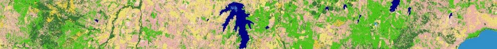
Sri Lanka
The first report described the publication of a World Bank Policy Research Working Paper last week by ├¢zdogan and Wang et al, titled ŌĆśField-Scale Rice Area and Yield Mapping in Sri Lanka with Optical Remote Sensing and Limited Training DataŌĆÖ.
As per the title, optical data was used to examine how weather, management, irrigation, and policy shifts impacted Sri LankaŌĆÖs rice sector over twenty years. This is interesting research because Sri LankaŌĆÖs monsoon climate often means the country is has cloud cover, plus the fragmented nature of smallholder rice farms made mapping difficult. However, the team have tailored optical satellite data from Landsat and Sentinel-2 to the phenology of rice, enabling them to isolate signals of flooding during transplanting and greening during growth.
The study was based on data between 2000 and 2022, and initially, rice was mapped via a rule-based classification system combining vegetation and water indices with automated thresholds to distinguish rice fields from other land uses. The second stage was yield estimation using a random forest regression model trained with government crop statistics together with a satellite-derived chlorophyll index and climate variables including rainfall and temperature.
This approach enabled the production of yield maps at 30-metre resolution across the country with an accuracy of more than 90 percent for area mapping, in particular the imagery achieved an accuracy of 91 percent in the 2020ŌĆō2021 Maha season and 93 percent in the 2021 Yala season. Yield predictions achieved error margins below 20 percent.
Given the importance of rice as crop, itŌĆÖs a food staple to over half the world, having a cost-effective, long-term, high-resolution dataset that can provide farmers and growers with actionable information offers a lot of potential. The technical approach of combining optical imagery with algorithms to overcome cloud cover, can also have potential to be applied to other crops. This is an exciting and interesting piece of research.
India
Moving north from Sri Lanka to India, last week they celebrated their 2nd National Space Day on the 23rd August 2025. As part of the celebration the Union Minister for Agriculture & FarmersŌĆÖ Welfare and Rural Development, Shivraj Singh Chouhan, gave a virtual presentation at the ŌĆśResearch and Development in Space Technology for Agricultural TransformationŌĆÖ event.
The Minister highlighted the role space science and technology is playing in developing agriculture and farming in the country, helping India achieve record food grain production. In particular, he noted the use of satellite data within applications such as meteorology through tools like Indian Space Research OrganisationŌĆÖs (ISRO) Geo Portal; crop yield forecasting; monitoring cropping systems; crop health data; and evaluating acreage for various crops. The potential of the recently launched NISAR mission, a joint ISRO and NASA venture, was also raised as it offers the possibility of improving the accuracy of estimates of soil moisture, crop health, and biomass across various land scales.
The ambition within India is to provide real time data direct to the farmers and growers to enable them to make decisions to improve food production.
Summary
It is interesting to see examples of the benefits to agriculture of satellite imagery, and how innovative approaches and applications are being developed to increase these benefits further.